

ATLANTIC MENHADEN
The Fish That Feeds the Atlantic.
And What Happens When It Is Gone.
Why Atlantic Menhaden Matter
Atlantic menhaden (Brevoortia tyrannus) are a crucial component of the Atlantic coastal ecosystem. These small, oily fish form the foundation of the marine food web, serving as a vital prey for many iconic predators.
Whales, dolphins, seabirds, and numerous commercially and recreationally important fish species, such as striped bass, bluefish, and weakfish, all rely on menhaden as a significant part of their diet.
Menhaden's ecological importance extends beyond their role as prey. They are filter feeders, consuming phytoplankton and zooplankton, which helps to maintain water quality and clarity.
By converting these microscopic organisms into protein and energy, menhaden serve as a critical link between primary producers and higher trophic levels in the ecosystem.

Reduction Fishing in the Atlantic
The Atlantic menhaden fishery consists of two main components: the reduction fishery and the bait fishery.
The reduction fishery, which accounts for the vast majority of menhaden landings, uses industrial-scale purse seine vessels to capture large quantities of fish.
The caught menhaden are then processed, or "reduced," into fish meal, fish oil, and other products used in animal feed, fertilizers, and dietary supplements.
Concerns have been raised for over 150 years (!) about the impact of the reduction fishery on menhaden populations and the ecosystem as a whole. Large-scale removal of menhaden can diminish the availability of prey for dependent predators, potentially affecting their health, reproduction, and population dynamics.
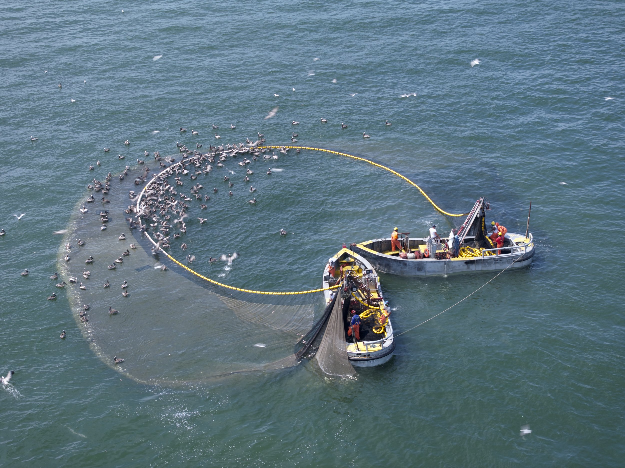
The menhaden reduction fishery operates on an industrial scale, using massive nets to capture enormous schools of these vital fish.
Here's how it works.
The Process
Spotting: Schools of menhaden are located using “spotter” planes or from the decks of large vessels.
Deployment: The massive net is set vertically in the water, surrounding the school of fish.
Closing the Net: A purse line, threaded through rings at the bottom of the net, is winched closed, trapping the fish.
Vacuuming: The mothership approaches the enclosed net and inserts a large vacuum tube. Fish are then sucked out of the net and into the ship's fish holds, which can contain millions of fish.
Retrieval: Once the fish are removed, a power block (a large hydraulic winch) pulls the net back onto the purse boats.
Duration: The whole process — per set — typically takes about 35-45 minutes from start to finish.
The Fleet
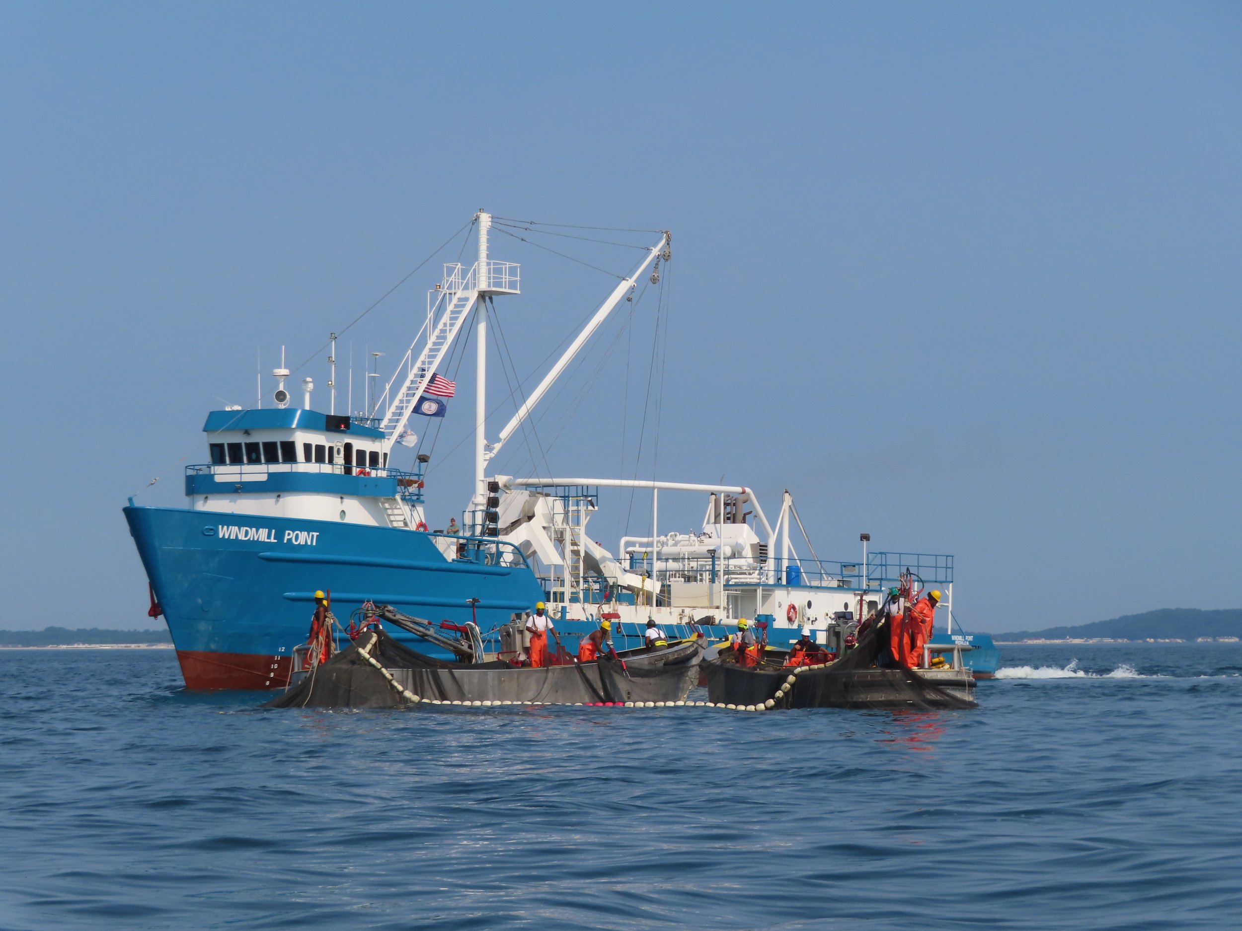
Vessels: the ~10 vessels operate out of Reedville, Virginia
Size: the largest ships measure around 192 feet and are capable of holding up to 2 million fish.
The Gear
Net Type: Purse seine nets, made of nylon fiber
Mesh Size: About 1 ¾ inches when stretched
Net Dimensions:
Length: 1,000-1,400 feet (that's longer than three football fields!)
Depth: 65-90 feet (as tall as an 8-story building)
Understanding these fishing methods is crucial for recognizing the scale of the menhaden reduction industry and its potential impact on our marine ecosystems.
With 10 “mothership” vessels, the Atlantic menhaden reduction fishery operates with a smaller fleet compared to the Gulf. The fleet is characterized by:
Capacity: Many vessels can hold up to 2 million fish, with some smaller vessels having a capacity of 1.3 to 1.5 million fish.
Age and modernization: The fleet includes a mix of older vessels (some dating back to the 1960s) and newer or recently converted vessels.
Ownership: The majority of the fleet is owned and operated by Omega Protein and its subsidiaries / partners.
This industrial fishing method is highly efficient at capturing large quantities of menhaden. However, it raises serious concerns:
Bycatch: Other species can be unintentionally caught in these large nets.
Ecosystem Disruption: Removing such large quantities of menhaden can have far-reaching effects on the marine food web.
Overfishing: The efficiency of this method makes it easy to overfish menhaden populations.
Habitat Disturbance: Deploying large purse seine nets that drag the bottom in shallow waters can result in damage to sensitive benthic ecosystems, including seagrass beds and bottom-dwelling organisms.
Atlantic Species at Risk
Menhaden are not one species' food. They are the shared food supply of an entire coast. When they disappear from a stretch of water, the effect shows up first, and most visibly, in the animals that hunt them.
Osprey. The clearest signal we have, because ospreys are the most closely counted raptor on the Atlantic coast. A 2026 study of 571 Chesapeake nests found that ospreys in menhaden-dependent waters raised 0.51 young per pair against a replacement rate of 1.15. The chicks hatch. Then they starve.
Common loon. Loons stage on the Chesapeake each autumn and form large cooperative flocks to feed on young menhaden through late October and November.
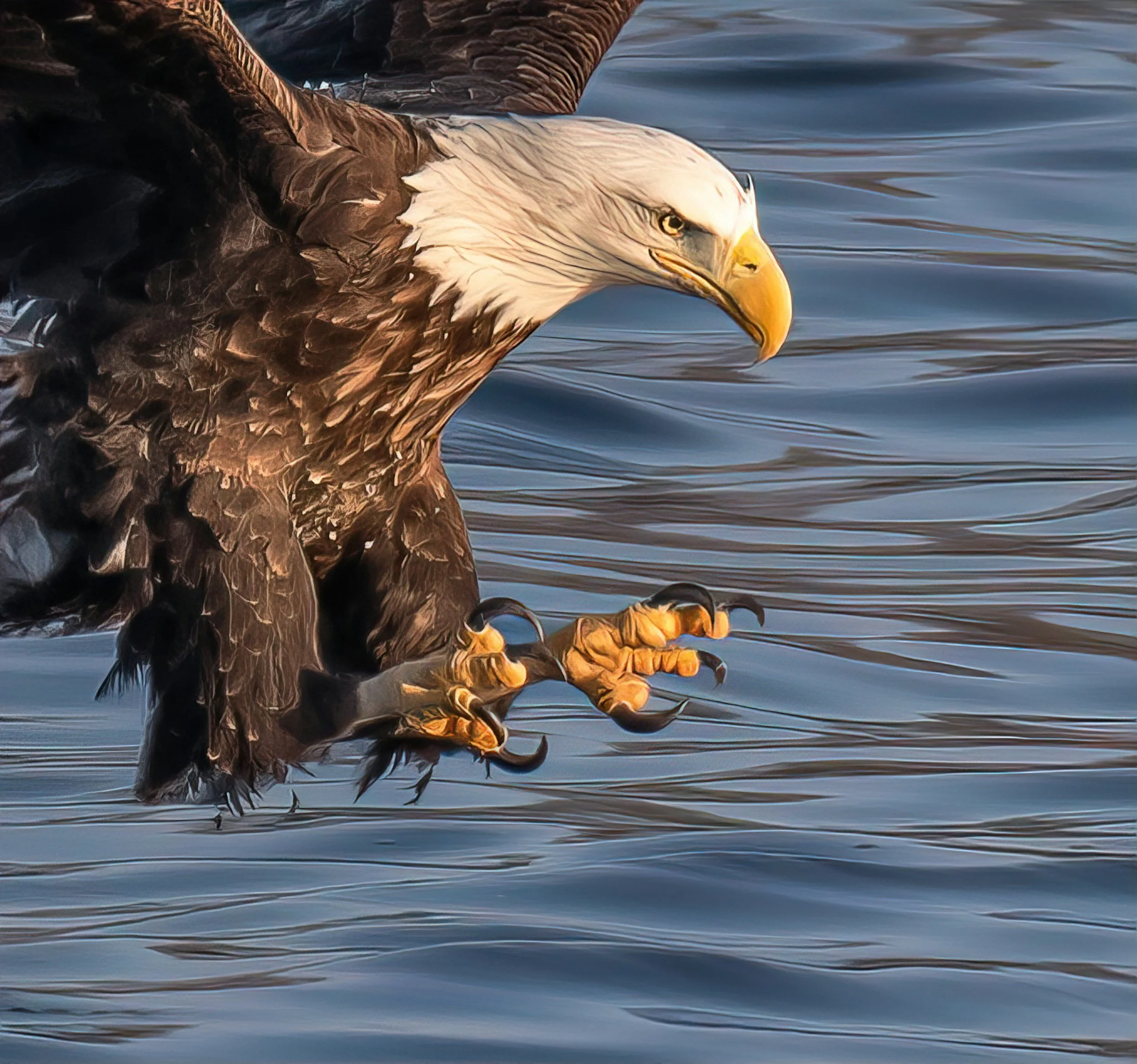
Bald eagle. In late summer and early autumn, eagles gather at Bay vantage points to take menhaden near the surface. On New Jersey's lower Raritan, a stretch that once held ten to thirty eagles a day at the height of migration now holds about four resident birds.
Northern gannet. Flock-feeding gannets crowd the mouth of the Chesapeake in December and January, taking the same young menhaden that the striped bass beside them are feeding on.
Brown pelican. Breeding colonies at Holland Island in Maryland, Shanks Island in Virginia, and Core Sound in North Carolina feed their chicks large quantities of one and two year old menhaden.
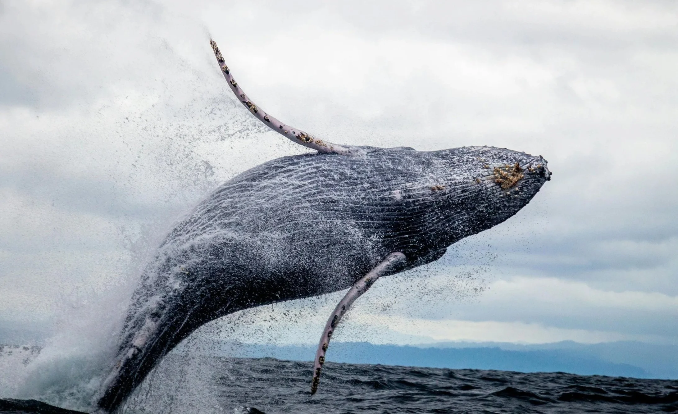
Humpback whale. Menhaden are an important prey species for humpbacks migrating along the Atlantic coast. Whale sightings track bunker schools closely enough that the public notices when both vanish together.
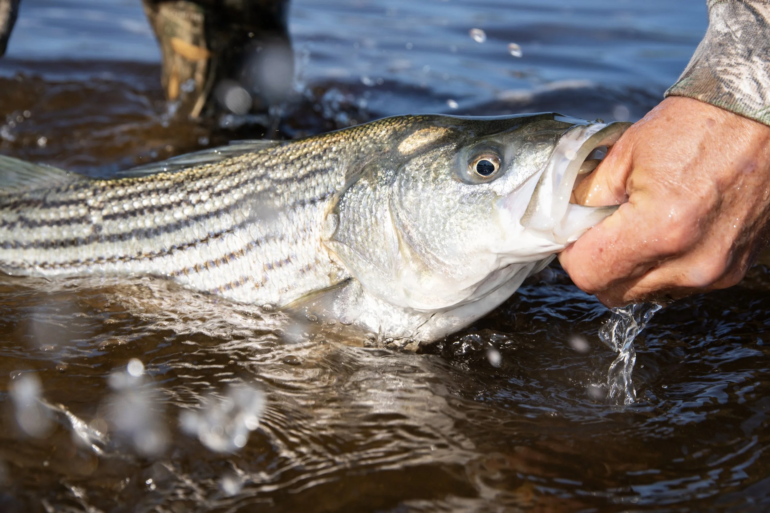
Striped bass, bluefish, & weakfish. Menhaden are a staple for the predatory fish that support the recreational fishery.

Atlantic Management Info
The Atlantic States Marine Fisheries Commission manages Atlantic menhaden across state lines, from Florida to Maine.
The direction of travel was right. In 2012 the Commission set the first coastwide catch limit. In 2020 it adopted ecological reference points, a genuine advance, meant to set catch limits with the needs of menhaden predators in mind rather than the fishery alone.
Then the numbers moved.
In October 2025, the Commission cut the 2026 coastwide catch limit by 20 percent, to 186,840 metric tons. Landings in 2024 were 186,155 metric tons. The reduction lands almost exactly where the fishery already was.
There is a deeper problem. When the ecological reference points were built, the original ecosystem model covered 61 groups and found that fish-eating birds were as sensitive to menhaden fishing as striped bass.
The model used to set the reference points cut those 61 groups down to 17. Birds were not among them. Striped bass became the sole indicator, and protection of everything else was, in the authors' own word, assumed.
Ecological reference points were the right idea. But a reference point only protects a predator it actually accounts for.

Atlantic menhaden caught as part of Maryland's Estuarine Fish Community Sampling Program. ©Frank Marenghi, MD DNR.
Where Have They Fished?
Use this interactive Global Fishing Watch map to track past fleet activity.
Our website incorporates Global Fishing Watch's (GFW) map service to provide comprehensive vessel tracking information.

Key Features:
Visualization of global fishing activity from 2012 onwards
Tracking of over 100,000 commercial fishing vessels
Open-access platform for public monitoring
Collaboration with leading scientific institutions for data analysis
Please note:
The map utilizes AIS (Automatic Identification System) data, which may not capture all fishing activity.
Vessels without AIS transmitters or those with deactivated units may not appear on the map.
The data represents a significant portion of the ocean's seafood catch, but not its entirety.
Temporal and spatial gaps in data may exist due to technical limitations or intentional data manipulation.
Disclaimer: The fishing activity information provided through Global Fishing Watch is for informational and research purposes only. While we strive to ensure the accuracy and comprehensiveness of the data, we cannot guarantee its completeness or reliability. This information should not be used for navigation or any purpose relating to maritime traffic safety. By using this map, you acknowledge that Menhaden Defenders and Global Fishing Watch are not responsible for any errors or omissions in the data provided. For the most up-to-date and accurate maritime information, please refer to official sources such as national fisheries agencies or international fisheries management organizations.
Legal Notice: Menhaden Defenders expressly disclaims and strictly prohibits any use of the information provided herein to threaten, harass, or commit any act of violence against any individual, vessel, or entity engaged in fishing activities. Any such actions are strictly forbidden and may result in civil and/or criminal penalties. Menhaden Defenders advocates only for lawful and peaceful means of marine conservation and resource management.
For more information about the data source, methodology, and terms of use, please visit GlobalFishingWatch.org.
BECOME A DEFENDER
Join the chorus of American citizens advocating for:
Sustainable, equitable fishing practices
Protection of vital marine ecosystems
Transparent, science-based management
Preservation of coastal community heritage
By providing your email, you agree to receive occasional communications
from Menhaden Defenders and you agree to our terms and conditions.